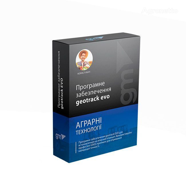
Geotrack Landwirtschaftliche Navigations-App für Android navigation system for wheel tractor


If you decide to buy equipment at a low price, make sure that you communicate with the real seller. Find out as much information about the owner of the equipment as possible. One way of cheating is to represent yourself as a real company. In case of suspicion, inform us about this for additional control, through the feedback form.
Before you decide to make a purchase, carefully review several sales offers to understand the average cost of your chosen equipment. If the price of the offer you like is much lower than similar offers, think about it. A significant price difference may indicate hidden defects or an attempt by the seller to commit fraudulent acts.
Do not buy products which price is too different from the average price for similar equipment.
Do not give consent to dubious pledges and prepaid goods. In case of doubt, do not be afraid to clarify details, ask for additional photographs and documents for equipment, check the authenticity of documents, ask questions.
The most common type of fraud. Unfair sellers may request a certain amount of advance payment to “book” your right to purchase equipment. Thus, fraudsters can collect a large amount and disappear, no longer get in touch.
- Transfer of prepayment to the card
- Do not make an advance payment without paperwork confirming the process of transferring money, if during the communication the seller is in doubt.
- Transfer to the “Trustee” account
- Such a request should be alarming, most likely you are communicating with a fraudster.
- Transfer to a company account with a similar name
- Be careful, fraudsters may disguise themselves as well-known companies, making minor changes to the name. Do not transfer funds if the company name is in doubt.
- Substitution of own details in the invoice of a real company
- Before making a transfer, make sure that the specified details are correct, and whether they relate to the specified company.
Seller's contacts


 Ukraine


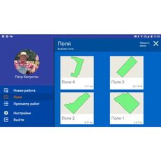


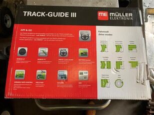
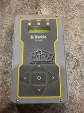


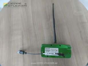
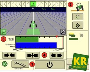

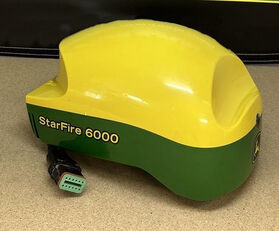


Along with the software, geotrack users can purchase highly accurate GNSS and RTK solutions which provide smoothed guidance and centimeter accuracy. Our solutions enable all farmers to build their own professional precision farming GPS/GNSS system at very low price for agricultural machinery such as tractors, harvesters, sprayers etc. The guidance application helps the farmer by showing the ideal track by gearing to straight or curve reference lines. The cultivated area, overlaps, speed of machinery and even time engaged in the work are all displayed.
Key features:
area measurement;
5 modes of agricultural guidance;
visualization and calculation of cultivated areas;
saving the measured fields and their processing;
calculation of overlaps;
automatic correction of the position of agricultural equipment;
functions "Pause" and "Resume" of work from the last point;
saving of works (new, in progress, completed);
display of works on Google Maps;
3D guidance mode;
"Day/Night" feature;
import/export of fields in kml format;
online tracking of works (server agroprofile.com);
synchronization of fields and works with agroprofile.com;
support for any GPS/GNSS receivers via Bluetooth, USB and RS-232
operation in RTK mode (centimetric positioning accuracy)
Unsere Lösungen ermöglichen es allen Landwirten, ihr eigenes GPS/GNSS-System für paralleles Fahren auf professionellem Niveau mit sehr geringen Kosten für landwirtschaftliche Maschinen wie Traktoren, Mähdrescher, Sprühgeräte usw. zu erstellen. Die mobile App Geotrack hilft dem Landwirt, indem sie die ideale Trajektorie in Modi paralleler Geraden oder Kurven sowie im Freimodus zeigt. Angezeigt werden die bearbeitete Fläche, Überlappungen, die Arbeitsgeschwindigkeit der Maschinen und sogar die in der Arbeit verbrachte Zeit.
Für die Installation der Software sind Geräte mit den folgenden technischen Spezifikationen erforderlich:
Betriebssystem: Android, Version 9 und höher
Google-Dienste: erforderlich (Google Maps, Play Market)
Bildschirmdiagonale: 7 Zoll und größer
Arbeitsspeicher: 2 GB und mehr
Bluetooth: ja
Wi-Fi: ja (für Berichte in Agroprofil erforderlich)
SIM-Karte: optional, falls Online-Tracking-Funktion benötigt wird
Hauptmerkmale:
Messung der Feldfläche;
5 Modi des parallelen Fahrens;
Visualisierung und Berechnung bearbeiteter Flächen;
Speicherung gemessener Felder und deren Bearbeitung;
Berechnung von Überlappungen;
automatische Korrektur der Position der landwirtschaftlichen Maschinen;
„Pause“ und „Fortsetzen“ der Arbeiten vom letzten Punkt aus;
Speichern von Arbeiten (neu, in Arbeit, abgeschlossen);
Anzeige der Arbeiten auf Google Maps;
3D-Steuerungsmodus;
„Tag/Nacht“-Funktion;
Import/Export von Feldern im KML-Format;
Online-Tracking der Arbeiten (Server agroprofile.com);
Synchronisation von Feldern und Arbeiten mit agroprofile.com;
Unterstützung für alle GPS/GNSS-Empfänger über Bluetooth, USB und RS-232;
Betrieb im RTK-Modus (Zentimetergenaue Positionierung).
Junto con el software, los usuarios de geotrack pueden comprar soluciones GNSS y RTK de alta precisión que brindan una guía fluida y una precisión centimétrica. Nuestras soluciones permiten a todos los agricultores construir su propio sistema GPS/GNSS de agricultura de precisión profesional a un precio muy bajo para maquinaria agrícola como tractores, cosechadoras, pulverizadores, etc. líneas. Se muestra la superficie cultivada, los solapes, la velocidad de la maquinaria e incluso el tiempo dedicado al trabajo.
Características clave:
medición de área;
5 modos de orientación agrícola;
visualización y cálculo de áreas cultivadas;
guardar los campos medidos y su procesamiento;
cálculo de superposiciones;
corrección automática de la posición de equipos agrícolas;
funciones "Pausa" y "Reanudar" el trabajo desde el último punto;
guardado de obras (nuevas, en proceso, terminadas);
visualización de obras en Google Maps;
modo de guía 3D;
Función "Día/Noche";
importación/exportación de campos en formato kml;
seguimiento en línea de obras (servidor agroprofile.com);
sincronización de campos y trabajos con agroprofile.com;
soporte para cualquier receptor GPS/GNSS a través de Bluetooth, USB y RS-232
operación en modo RTK (precisión de posicionamiento centimétrica)
Wraz z oprogramowaniem użytkownicy geotrack mogą zakupić bardzo dokładne rozwiązania GNSS i RTK, które zapewniają płynne prowadzenie i dokładność centymetrową. Nasze rozwiązania umożliwiają wszystkim rolnikom zbudowanie własnego profesjonalnego systemu GPS/GNSS dla rolnictwa precyzyjnego po bardzo niskiej cenie dla maszyn rolniczych, takich jak traktory, kombajny, opryskiwacze itp. Aplikacja naprowadzania pomaga rolnikowi, pokazując idealny tor jazdy, ustawiając bieg na prostą lub zakręt linie. Wyświetlany jest obszar uprawny, nakładki, prędkość maszyn, a nawet czas pracy.
Kluczowe cechy:
pomiar powierzchni;
5 trybów prowadzenia rolniczego;
wizualizacja i obliczenie powierzchni uprawnych;
zapisywanie mierzonych pól i ich przetwarzanie;
obliczanie nakładania się;
automatyczna korekta położenia sprzętu rolniczego;
funkcje „Pauza” i „Wznów” pracy od ostatniego punktu;
zapisywanie prac (nowych, w toku, zakończonych);
wyświetlanie prac na Google Maps;
tryb nawigacji 3D;
Funkcja „dzień/noc”;
import/eksport pól w formacie kml;
śledzenie prac online (serwer agroprofile.com);
synchronizacja pól i prac z agroprofile.com;
obsługa dowolnych odbiorników GPS/GNSS przez Bluetooth, USB i RS-232
praca w trybie RTK (centymetryczna dokładność pozycjonowania)
Наші рішення дають змогу всім фермерам створювати власну GPS/GNSS систему паралельного водіння професійного рівня точності за дуже низькою ціною для сільськогосподарської техніки, такої як трактори, комбайни, обприскувачі тощо. Мобільний додаток geotrack допомагає фермеру, показуючи ідеальну траекторію, в режимах паралельних прямих або кривих ліній, та вільного режиму. Відображаються оброблена площа, перекриття, швидкість роботи техніки і навіть час задіяний в роботі.
Для встановлення програмного забезпечення знадобиться пристрій з наступними технічними параметрами:
Операційна система: Android, версія 9 і вище
Сервіси Google: обов'язково (Google Maps, Play Market)
Діагональ екрану: 7 дюймів і вище
Оперативна пам'ять: 2 Гб і вище
Bluetooth: так
Wi-Fi: так (якщо потрібні звіти в Агропрофіль)
СІМ-карта: за бажанням, якщо потрібна функція трекінгу онлайн
Основні можливості:
вимір площі полів;
5 режимів паралельного водіння;
візуалізація та підрахунок оброблених площ;
збереження виміряних полів та їх обробка;
розрахунок перекриттів;
автоматична корекція положення с/г техніки;
функції «Пауза» та «Продовження» робіт із останньої точки;
збереження робіт (нові, у роботі, виконані);
відображення робіт на Google Maps;
режим керування 3D;
функція «День/Ніч»;
імпорт/експорт полів у форматі kml;
онлайн-трекінг робіт (сервер agroprofile.com);
синхронізація полів та робіт з agroprofile.com;
підтримка будь-яких GPS/GNSS приймачів через Bluetooth, USB та RS-232
робота в режимі RTK (сантиметрова точність позиціонування)